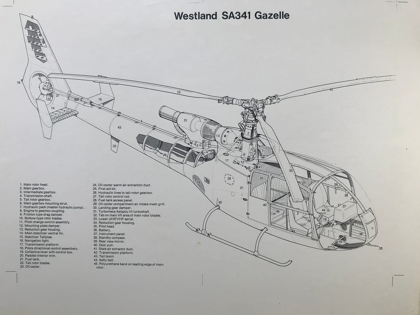
Many of you in the climbing community have probably seen Jeremy Ashcroft’s work — even if you don’t know who he is. Jeremy started work as technical illustrator, doing precision drawings of complicated equipment. These are the kinds of illustrations Jeremy was originally working on:
“I Certainly Enjoy Doing big Faces, big Walls and Crags. So, the Climbing Terrain, I really find that Quite Challenging. That’s the sort of Place I want to be, so I Enjoy Drawing it.”
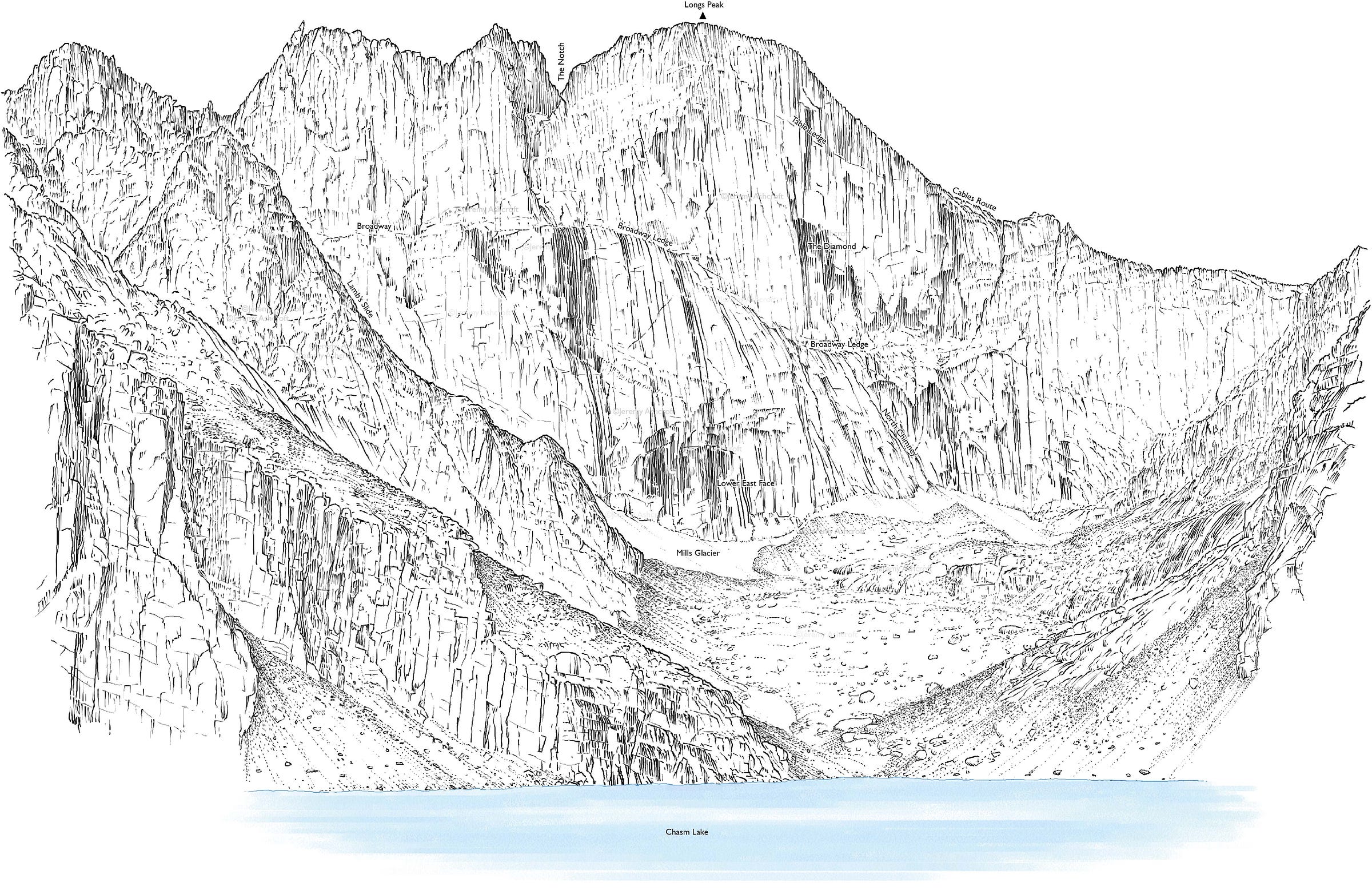
Jeremy was working on drawings for nuclear submarines when he had the idea to approach mountains with the same precision, capturing incredible detail in ways that conventional maps or drawings simply can’t.
“I was pretty bored with what I was doing and I thought, I could apply the same sort of stuff to mountains — I mean, as a mountaineer I was obsessed with that as well — And I thought, oh, if I can draw a complicated thing like a nuclear submarine, I can surely do the same for a mountain.”
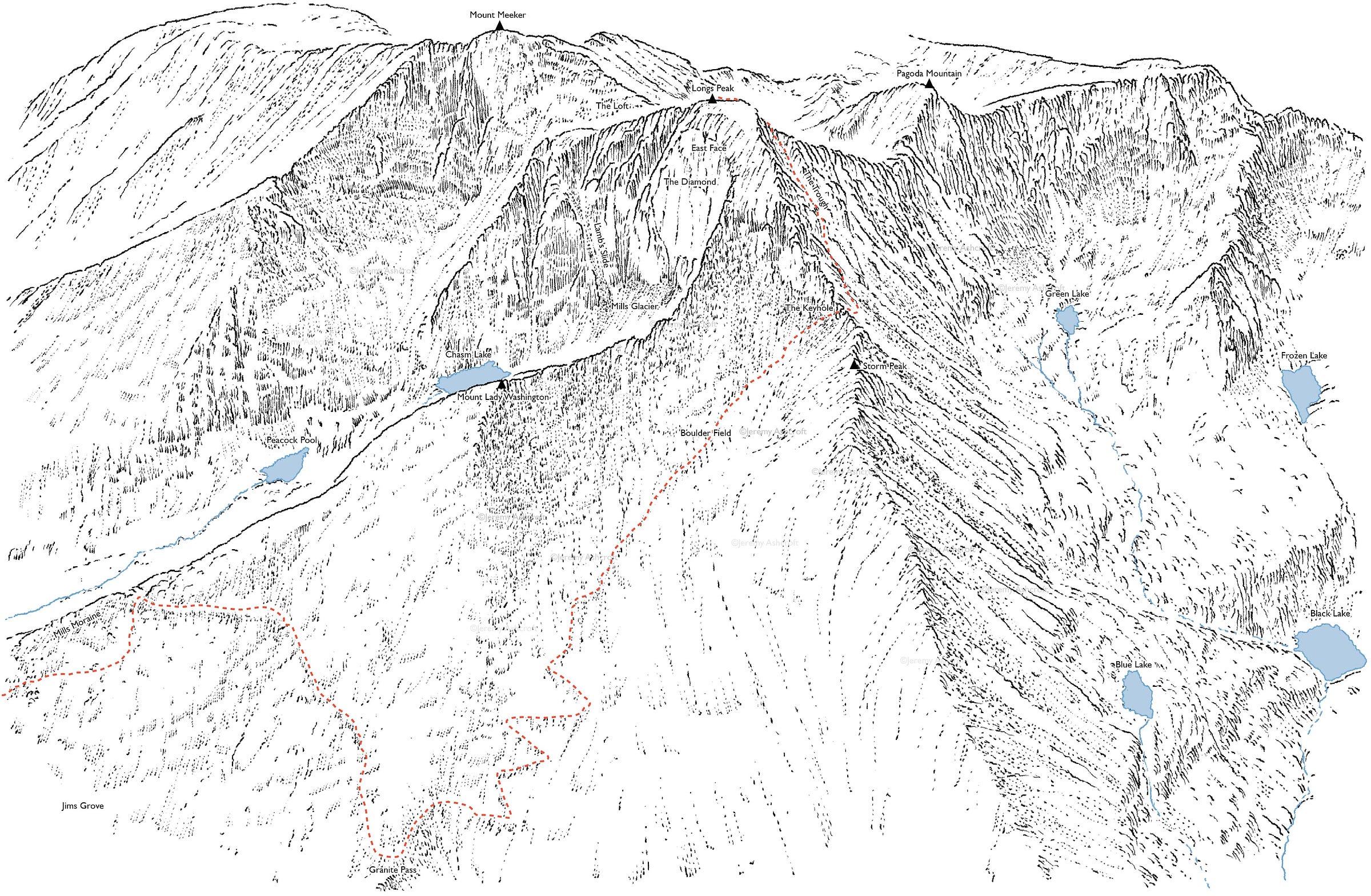
“It Gelled with People. They Could see Familiar Locations. They Could see it from a High Viewpoint, but it was still Recognizable to Them on the Ground.”
Jeremy got his start climbing in the Alps of Europe, visiting Colorado after completing his degree. While in the United States, he was struck by how accessible the 14ers are.
“I was used to big mountains in the alps. but to be confronted by so easily-accessible mountains, I thought it really appealing. 30 odd years later, I thought ‘well why hasn’t somebody illustrated these peaks because they’re such beautiful mountains.’”
Interview Notes
0:45 — Earliest memories art
2:00 — What is a technical illustrator?
4:30 — From nuclear submarines to mountains
6:00 — Jeremy’s time in the United States
8:35 — How Colorado 14ers differ from other mountains around the world
13:30 — The evolution of climbing resources
16:00 — Working for Trail Magazine
18:50 — How Jeremy picks his peaks to draw
22:00 — Finishing the 14ers project
23:00 — How to draw things you’ve never seen
“To Summit Most of Those, You’ve Really — Unless You’re Crazy — You’ve Really got to Rope up and use Alpine Techniques to do that.”
There are also big differences to how climbers on this side of the pond approach popular peaks.
To be blunt: we’re spoiled in Colorado. In the Alps, Jeremy says climbing is very technical. Climbers must contend with glacier conditions. Ropes are necessary. Summit attempts are multi-day expeditions. The idea of trailheads within spitting distance from the summit are unheard of.
“In the alps, a lot of people come to them as climbers. Where as in Colorado and perhaps in California as well, people can come to them as hikers and they can summit relatively easily. It’s not a light undertaking. I don’t dismiss them easily because they’re serious mountains, but it’s more accessible.”
Jeremy found climbers in Colorado to be more tolerant of risk; skirting across high-exposure sections that European climbers would absolutely use roped protection to traverse.
“It’s Almost like a Three Dimensional Chess Game. I want to try to Visually Unlock the way Ahead.”
We have a lot of resources available to us these days, as climbers. Topographical maps and GPS are nice. But sometimes the best way to understand a route is to see how it looks in real space. That’s why the beta on guide sites like 14ers.com include descriptions and pictures along with maps.
“You’re looking for the sort of slightest indication of someone being there before. If there’s wear on a foothold, if there’s missing bit of greenery or scrub — you can tell when a route’s got traffic. And I apply that sort of logic to the route finding with these illustrations as well. I try to put enough detail in there that people can pick out key features.”
Jeremy’s illustrations meld all of these features into one easy-to view image, that could appear in a guidebook just as easily as a gallery. In fact: Jeremy’s work has culminated in four books, and a two decade stint as Mountaineering Editor for Trail Magazine.
If you’d like to check out Jeremy’s work: he sells prints of his drawings, you can see more of his work by clicking the button below. You can also follow his work on Instagram or Twitter.
I Want to Hear from You
What do you think of Jeremy’s maps? At the end of our interview, he explained that he’s always looking for feedback to improve his renderings of the various routes and peaks that line our horizon.
Do you think these are a helpful resource in planning trips?







Podcast #17: Mapping the 14ers with Jeremy Ashcroft